Wing Pond

Central Newfoundland

The Wing Pond Project

The Island of Gold

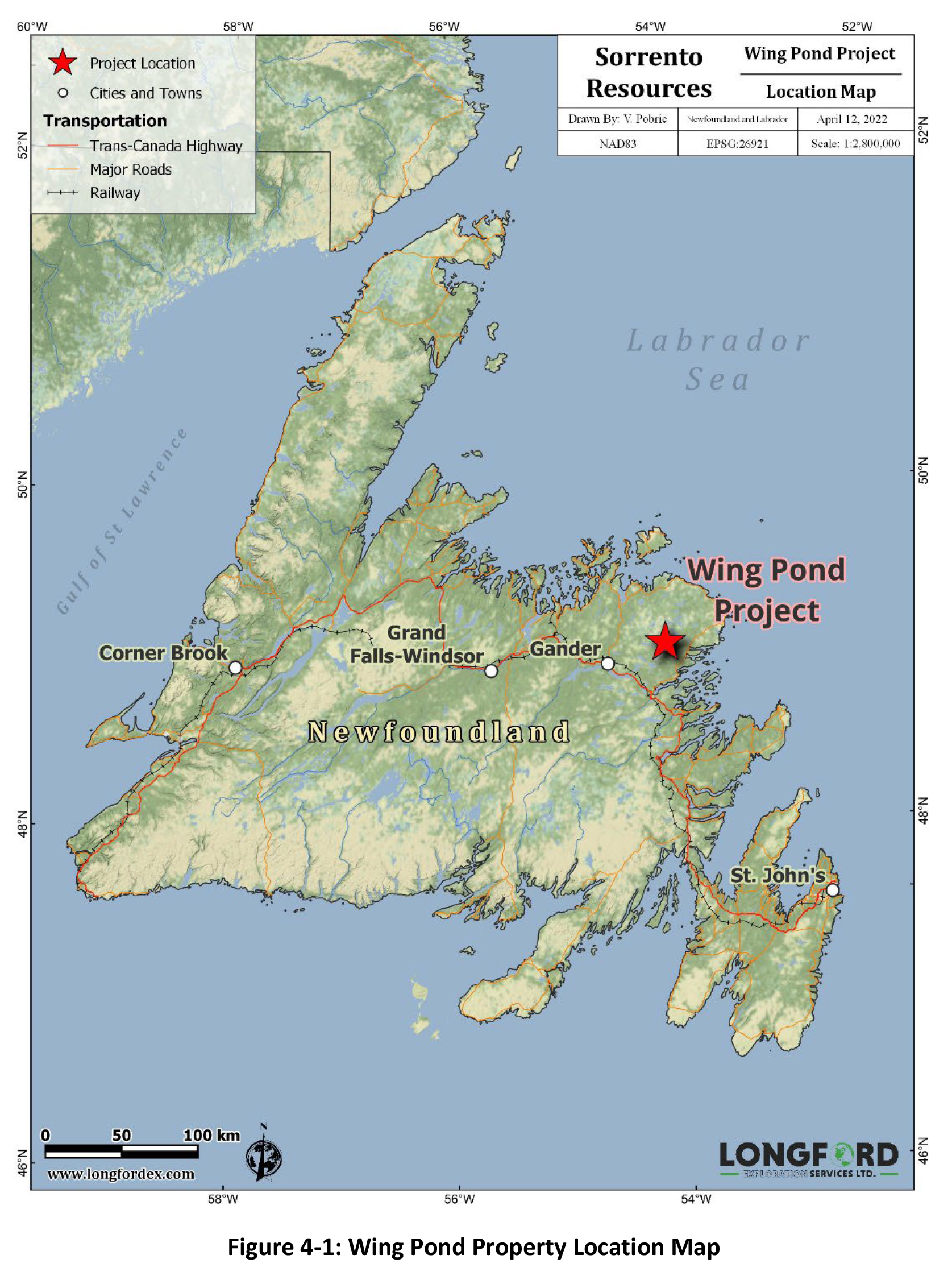
The Wing Pond project is located 40 km east-northeast of Gander, Newfoundland, Canada. It is a mining-friendly jurisdiction with very reliable transportation and excellent power infrastructure.

The Province is host to a strong workforce and is very business friendly, which is why the provincial government has announced an initiative to build 5 new mines by 2030.

Property Ownership

The Wing Pond Property consists of three separate blocks of mineral claims comprising seven (7) Newfoundland and Labrador mineral licenses encompassing 462 mineral claims which covers an area of approximately 11,550 hectares. Sorrento Resources has the rights to acquire 100% interest in the Wing Pond Project under the terms of the option agreement.
History

The Gander Gold Belt

The Gander Gold Belt is one of Newfoundland’s largest and most prospective land packages for new grassroots discoveries. Historical exploration is indicative of auriferous prospectivity, with several gold discoveries in the Gander Gold District that are being actively developed.

The region is host to several developing high-grade zones including New Found Gold’s spectacular Keats Zone as well as Marathon Gold’s Valentine Lake Deposit. These encouraging discoveries have positioned Newfoundland as one of the world’s most prolific emerging gold districts.

Geology

Promising Geochemistry

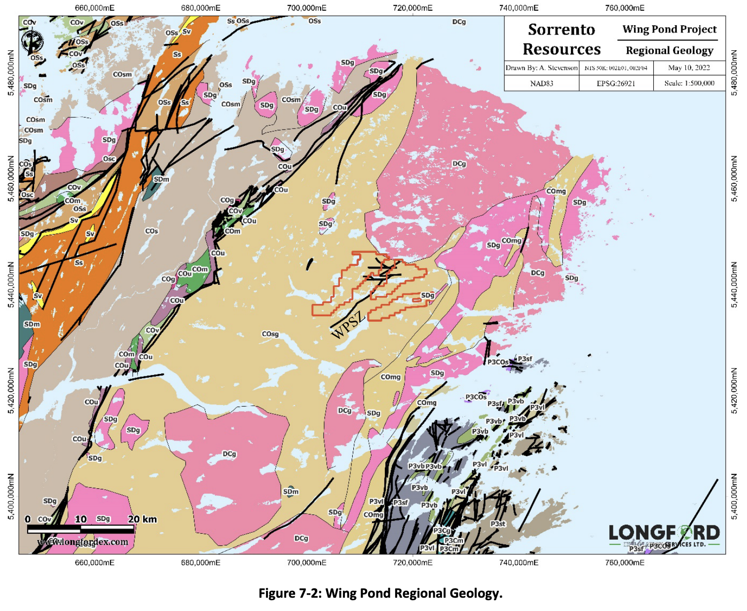
The Wing Pond project is located in an area with well-documented geology that is host to multiple mineralized showings that are under-explored. Anomalous gold-arsenic zones have been identified from government regional till and soil sampling surveys that may relate to shear hosted gold mineralization.

Key features of the project include its proximity to the ~40 km long Wing Pond Shear Zone (WPSZ), a high strain shear zone that is ~10 km across. This structural setting is prospective for quartz-carbonate vein-hosted gold mineralization.
2022 Airborne Magnetic Gradiometer Survey (AXIOM)

In 2022, Sorrento commissioned Axiom Group (Axiom) to fly a high-resolution helicopter-borne tri-axial magnetic gradiometer survey over the Wing Pond Property over 2 days between March 17th and March 18th, 2022. A total of 755 line-km of gradient magnetic data was collected. The survey was flown at 100 m traverse-line spacing and 1,000m tie-line spacing (Figure 9-1).
The Wing Pond heliborne-magnetic survey data received from Axiom included the final survey deliverables; all raw, helicopter-borne, magnetic data; base-station data; a final leveled dataset, including all measured gradients; and the following maps: flight paths, measured vertical gradient (MVG), residual magnetic intensity (RMI), and total magnetic intensity (TMI) (Figures 9-3 to 9-5).
A 3D inversion of the magnetic data was also completed by Axiom, the unconstrained susceptibility inversion depth slices are presented in Figures 9-10.

Subscribe For Updates

Subscribe to our email newsletter to receive the latest news, updates and announcements from Sorrento Resources right to your inbox.